File:Hacktion2009map.jpg
Jump to navigation
Jump to search

Size of this preview: 667 × 600 pixels. Other resolutions: 267 × 240 pixels | 939 × 844 pixels.
Original file (939 × 844 pixels, file size: 150 KB, MIME type: image/jpeg)
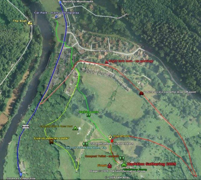
Updated map Barn Camp with foot/vehicle access routes maped out.
File history
Click on a date/time to view the file as it appeared at that time.
| Date/Time | Thumbnail | Dimensions | User | Comment | |
|---|---|---|---|---|---|
| current | 11:11, 10 May 2010 | | 939 × 844 (150 KB) | Acesabe (talk | contribs) | Reverted to version as of 11:15, 9 June 2009 |
| 10:49, 10 May 2010 | 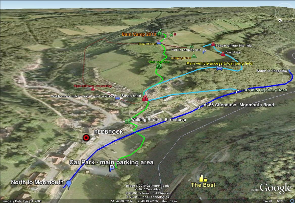 | 1,168 × 807 (193 KB) | Acesabe (talk | contribs) | Updated access routes and improved info | |
| 12:15, 9 June 2009 |  | 939 × 844 (150 KB) | Acesabe (talk | contribs) | New improved! | |
| 14:42, 8 June 2009 | 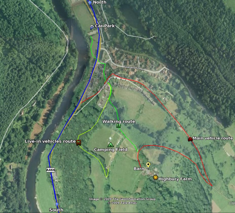 | 928 × 841 (137 KB) | Acesabe (talk | contribs) | Updated map of Highbury Farm with foot/vehicle access routes maped out. |
You cannot overwrite this file.
File usage
There are no pages that use this file.